
Kav Medida provides professional support in the oversight of projects in accordance with the planner's requirements throughout the life of the project - all while streamlining processes and providing quality control.
The Process
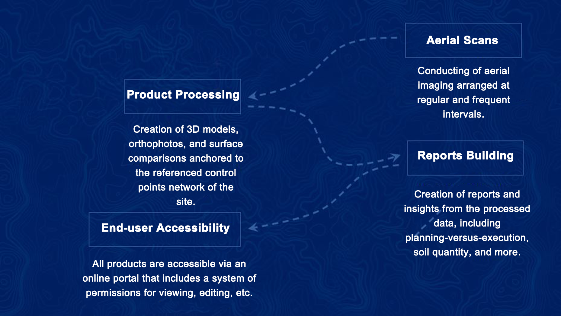
Accessibility
The photographs and the 3D model are accessed through a cloud system and are available for viewing via the browser, smartphone, and desktop application for all project consultants.
Core Abilities
Include: Taking a virtual tour of the site as if you had really walked through it while jumping to different points in time, analyzing its planning versus execution, reporting of quantities, extraction of cross sections, and cost analysis. Also included in the abilities, is the presentation of located and planned infrastructures + collision detection, and viewing orthophoto and 3D products with an uncompromising resolution of 1.5 cm per pixel while fully adapting to a control network of up to 1:250 scale ratio.
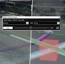
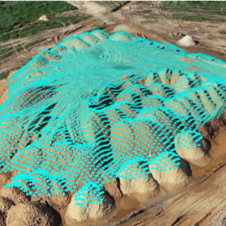
Comparison between the planned surface and the existing conditions
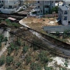
Locating and coordinating underground infrastructures - existing versus planned
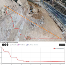
Analyzing cross sections in real time, and exporting to CAD systems with a click
Calculating soil volumes compared to a planned surface in 3D, and issuing an accurate report
Comparing two time periods and analyzing insights
Taking cross sections from anywhere in the field
For inquiries or a demonstration of Kav Medida's capabilities, contact us today: Send us a note